


Article and Photos by J.B. Chandler
The interstate is faster, no doubt about it. But the journey to Glacier National Park should be as beautiful as the destination.
Before the interstate highways, one had to drive through every town. On Highway 89, that’s what you’ll want to do. Each town has its own character; each has its unique set of views and destinations. As we go further and further north, the mountains come closer and closer to the road. It’s a highway atop the benchlands, on the edge of the high plains, but with a clear view of the mountains. There are many places to visit, just off the road, that rival our destination’s beauty, but lack the tourist crowds.
So pack the car, keep your camera ready, and drive a little slower today. We don’t want to miss anything.
Vaughn: The Journey Begins
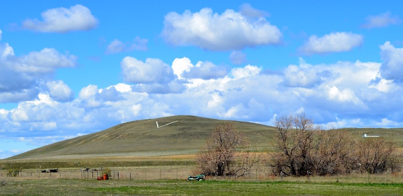
Highway 89 was once the primary route to Glacier National Park (GNP), and Vaughn, Montana is our first stop. The “Leavings” area west of Great Falls has always been an important travel crossroads. The slow, meandering Muddy Creek has cut a deep trough running north and south, forcing most wagon trails to run nearby the Sun River, whose ancient crossing lay just south of Vaughn. A miner-turned-rancher who helped start the city of Great Falls, Robert Vaughn, sold his land at this intersection, and when the “Turkey Trail” road (the Great Falls and Lethbridge Railroad) was built north from this location, the town of Vaughn was born. Eventually, the north-south interstate and then Highway 200 going west to Missoula were built, increasing Vaughn’s stature; yet, Highway 89 was built first and is the first great road to GNP.
Like any great crossroads, Vaughn has a few gas stations, a few bars, and a few hundred people. The growing town benefits from its proximity to Great Falls, being a bedroom community for many. With more people, more services must be built. A bank, a vet’s clinic, and a tire shop lay right on the main strip, but also a few hunting outfitters and an elementary school lay within town too.
Some travelers only stop at the gas station for a quick bite, and that’s a shame. Big Sky Deli is a newer sandwich shop in town and is ten times better than any franchise. For those wanting a quick break, we stop at the Office Bar. The atmosphere is great. The Silver Spur across the way has good burgers too.
A hub of transport on the edge of the prairies and the benchlands, Vaughn is a small town on the rise.
Blackleaf Recreation Area
Bynum may be a spot for some to pump on their brakes, but for others there is much to do. Now, if we wanted to skip Glacier National Park and head into the mountains west of Bynum, we may have a great reason: Blackleaf Recreation Area. Unlike the saloon in town, the Blackleaf is an actual wildlife preserve, and one with ample opportunities for recreation. Plus, unlike Glacier, you can bring your dog along.
The Blackleaf Rec Area lies between two river valleys, with the wall-like Volcano Reef in the middle and Mount Werner rising above it all. On the northern edge of Blackleaf Rec Area, is the Blackleaf Creek canyon. The creek isn’t much to behold (yet it washes out the road) but the staggering cliffs on either side of the creek are majestic, and daunting. That’s why this rock face boasts some of the best rock climbing along the Rocky Mountain Front. According to one website, 22 climbs can be had, each with different names like “Blowhard” or “G Force,” and my favorite, “Home Boys on Soy.” The best—and worst—aspect of climbing this area is you and your group will probably be alone, so take your time, have fun, and be safe.
The southern border of the Blackleaf is the Muddy Creek and her ever narrowing canyon. To get to the trailhead, one must navigate a very rocky road, so check your tires before coming out. Once there, the short hike will lead you past an abandoned mine and into the narrow Muddy Creek canyon. The gap between the cliff faces begins quite wide, but the walls slowly collapse upon you, and when the canyon is but a few feet wide, the Muddy Creek Falls cascades down from between the rocks, creating an amazing, and very cold, waterfall.
Rock climbing, antler hunting, and waterfalls—the Blackleaf Recreation Area offers up Montana, without the crowds of Glacier National Park. Camp at Bynum Reservoir and visit the Rocky Mountain Front in relative solitude. Well, except for May 15 at noon. That day, come early and be ready to run for those antlers!
Bynum: Dancing with Dinosaurs
How can such a small town have so much in it? Bynum, population 31, has as much culture (and fun!) as a town 100 times bigger. The small blip on the road may not appear to have much, but what it does have is a giant dinosaur guarding the entrance.
“Rusty” is the name of that dinosaur, and he stands before the Two Medicine Dinosaur Center. The life-size dinosaur replica yells into the distance, exposing ferocious teeth that could chew down a human in two bites. The Two Medicine Dinosaur Center is one of 14 museums that make up Montana’s Dinosaur Trail, which, when coupled with the Old Trail Museum, means the passing traveler can visit many different dinosaurs on their way to Glacier. Perhaps an hour at the museum is not enough? Sign up for one-, two-, or five-day expeditions where you will be working alongside the resident paleontologist of Bynum to discover the next dinosaur fossil. (Visit their website for more information.) Plus, visit the T-Rex Agate Shop across the way before you take off.
Never judge a book by its cover; J.D.’s Wildlife Preserve is a fancy, but misleading name for Bynum’s only bar. This little bar becomes the social gathering spot for the whole area. Now for actual wildlife viewing, head west a few miles and visit Bynum Reservoir. Good fishing and good views can be had, along with some great nature watching.
The final flurry of fun we can have in Bynum is to chat about their one-room schoolhouse. Students still do their reading, writing, and arithmetic at this elementary schoolhouse, but the exciting thing they learn to do is dance. Starting in first grade and continuing until the students move on to high school, they will learn to master ballroom dancing, the polka, and more. The school even invites bands to come to their school so the kids can practice their craft live. It makes me wonder if we should be exchanging dodgeballs for dancing shoes across our nation.
With so much, it’s surprising how small Bynum remains; however, that small town charm has led us to a unique place where after the fishing and dinosaur digging, it will be easy to find somebody to dance with at J.D.’s, even if it’s a waltz!
Detours around Duper
Recent years have seen the Montana Highway Department upgrade Highway 89 between Bynum and Dupuyer—a beautiful stretch of road that was so twisty and narrow, that even in perfect driving conditions on a sunny day, seemed dangerous. All that has changed. Well, except for the beauty around Dupuyer, Montana.
Dupuyer is very small, but boasts some top-notch amenities. If you are an evening traveler, go visit Buffalo Joe’s Eatery and Saloon. The recommendations you hear from your neighbors are spot on; it’s delicious. The Dupuyer Cache is a small grocery store of sorts, and a few churches serve the people in the few houses. There remains a U.S. Post Office at the center of town.
The Dupuyer Creek runs slowly on the north side of town, and the first detour we will travel down is called Dupuyer Creek Road.
The Boone and Crockett Club is an organization that works for the conservation and preservation of wildlands and wetlands for wildlife. Founded in 1887 by Theodore Roosevelt, the headquarters for the Boone and Crockett is in Missoula, but the laboratory for the organization lies eight miles southwest of Dupuyer. An amazing location with breathtaking views, it is worthy of a short visit.
Another detour, just past Birch Creek, would allow one to drive a loop through Heart Butte and emerge back onto Highway 89 just south of Browning. The nearby mountains make for many amazing views, but Heart Butte doesn’t offer any services, so come prepared!
Heart Butte: The Heartbeat of Montana
Some places in Montana seem to feel more magical as you get closer. The air is colder, but cleaner, and one can see the details of trees and rock and cows grazing along the Rocky Mountain Front. Driving into Heart Butte, you pass a giant majestic rock—the buffalo rock, they call it. Road construction in the 1950s dredged up this giant rock, but its destiny wasn’t gravel or sand. It’s a road marker. We are entering a special and magical place; we are going to Heart Butte.
Her namesake comes from the mountain jutting up just a few miles west of town. Heart Butte is the only town within Pondera County that is also part of the Blackfoot Indian Reservation. Swift Dam, on Birch Creek, sits some 10 miles south of Heart Butte, and from there to Heart Butte and wrapping all about the mountain was the Spotted Eagle fire. The 50,000-acre fire forced the small Class C town to be completely evacuated. Along with the other 100+ fires raging across the west, the Spotted Eagle blanketed the entire state of Montana in her gray soot.
A few weeks earlier, Heart Butte wasn’t black and gray; she was a showcase for color and pageantry. The Heart Butte Society Celebration, or more simply the Heart Butte Pow-wow, is an annual event held the second weekend of August. Much like the circular dancing of the participants, the parking and campgrounds filled with fifth wheels and teepees encircle the fairgrounds on a one-way loop. Movers and shakers of all ages join in the many waves of dancers. Every color imaginable—in every possible combination—mix and match in perfect rhythm with the dancers. Bring a camera, find a seat, and get lost in the colors.
There are several vendors to get Indian tacos and fry bread, of course, but also good fellowship and conversation. Under the steel roofed, 3-walled building is the big event of the weekend: The Stick Game. How big? How about $22,000 in guaranteed payouts sort of big? The Pat “Bum” Calf Ribs Sr. Memorial Stick Game Tournament happens on that Saturday afternoon and should be considered the centerpiece of the celebration. One must play to fully understand the game, but essentially two contestants (or two teams of two) must gather all of the sticks in the game by guessing how many sticks one’s opponent holds. Bluffing, guessing, and lots of money, and one doesn’t have to deal with poker cards or flushes.
Heart Butte is a microcosm of Montana as a whole. Heart Butte is nestled in some beautiful, magical country, but with hellfire and smoke barreling down upon them, the community had to evacuate in 2016. Fortunately, the town was saved and the people of Browning set up a shelter for those needing a place to stay, while the Salvation Army of Helena sent food and a team to help assist the evacuees. Montana, despite her beauty, can be a difficult place to live. It’s always assuring knowing that Montanans will often come to the aid of other Montanans; we will make it through this Montana together!
Browning: The Last Stop Before Glacier
Glacier National Park looms in the distance. We can clearly see the rocky valleys of St. Mary and Two Medicine. In the far distant north we can make out Chief Mountain. We’re not in Glacier yet, though we’re going through our last major town on the road: Browning. In fact, it’s the largest town on Highway 89 and an often skipped-over point en route to GNP. Here are a few reasons to stop and hang out:
To the west of the river crossing is a historical marker for Coldfeet School, a one-room school built for Blackfeet children during the New Deal. To the east is one of the earliest schools on the reservation, Holy Family Catholic Mission, built in 1889. All that remains is the renovated church, the Holy Family Mission, which holds mass on Sunday mornings.
Another great stop is Nation Burger Station! Just past the giant white teepee coffee shop, look for the best drive thru around. Buffalo burgers for sure, but my favorite pre-hike sandwich is the Southwestern Berry Burger which sounds good enough, but with a fry bread bun?! It is amazing!
A quick reminder here to stock up at one the grocery stores in Browning. Load up on ice and sunscreen at Teeple’s IGA or Glacier Family Foods.
The western edge of town carries many of Browning’s cultural treasures. A giant statue sits on the north side of the road and acts as a signpost for more good things to come. A picnic area and the Pow-wow grounds lie just past the statue, but the giant parking lot that follows encircles the Museum of the Plains Indian. For an inexpensive $5 you could spend at least an hour learning about the culture and another hour admiring the many outfits of the Plains Indians.
The Gray Wolf Casino – one of the largest casinos in Montana—lies in the same complex as the museum. Attached to the casino is a nice three story hotel too.
Glacier National Park is so close, that some people wish to skip Browning and drive the last 30 miles into Glacier. But this unique town has food and culture that is worth your stop, even if it is just a few minutes. Especially if you are hungry!
Great Spots along Highway 89
A fast car could drive from Great Falls to Glacier National Park in about two hours, but one would be missing out on so much cool stuff in between. We have explored the many small towns, so let’s take a look at a few historical and geographical spots just off Highway 89.
The buttes and cliffs of the Montana prairie are certainly beautiful, but they once had a more important use: food production. The First People’s Buffalo Jump between Vaughn and Ulm is worth the five mile detour. Imagine, after leading the curious bison herd to the edge of the cliff, the hidden hunters would rise up, spooking the herd, who would then charge headfirst over the cliff. Below, other hunters would collect them. A good 3-mile hike leads us from below the cliffs to a promontory above the plains where we can see Great Falls, the Rocky Mountain Front, and the rest of our trip up Highway 89.
The most famous barn in Montana lies between Vaughn and Sun River, right before the turn to Fairfield. The barn is just off the road, and being tucked behind dense tree coverage and farm equipment, the J. C. Adams Barn can be hard to find. Don’t look for a big, red wooden barn; this barn is made of giant sandstone bricks, quarried from nearby sources. The mighty arch was “imported” from St. Louis in 1885, which would’ve come by steamboat, not railroads. A rollerskating party debuted the opening of this barn/social gathering spot, but today, it has fallen into disuse. Thankfully, many organizations through the years have taken on the task of saving and preserving this amazing relic. During this process, the original horse weathervane needed to be replaced. (The new one looks great, but does it have a 120-year warranty?)Rising above the nearby trees, the horse will be our guidepost as no historical signage will alert us to this barn.
The buttes and ridges around Great Falls were a source of great inspiration to Montana’s greatest artist, Charlie Russell. A few miles before entering Fairfield, there is an intersection with Simms Road. Turning lanes exist, so wait for them. Go south, and within one mile the road falls quickly from the Fairfield flats to the Sun River drainage below. This narrow road offers a dramatic view of Fort Shaw and Square Butte to the east, and a long ridge to the west. A parking spot exists at the top of the rise, but the road is narrow, so take pictures carefully!
The southern boundary of the Blackfeet Indian Reservation was once the Teton River. A fort and agency building existed, built in the 1860s, then abandoned in 1876. All that remains today is a large foundation rock. The Old Agency on the Teton roadside marker lies just past Choteau, and the rock itself lies nearby. Unfortunately, a right-of-way does not. Friends of the Old Agency on the Teton is working to make this location more accessible; alas, today there are more cow tourists than humans.
The current border for the Blackfeet Indian Reservation is Birch Creek. Just north of Birch Creek on Highway 89 we will see a big rock monument. When the Swift Dam failed in 1964 it sent a 30-foot wall of water down the river. Twenty-eight people died that day and a monument was built in their honor. The monument can easily be seen from the road, but Swift Dam is a little farther of a drive.
Fifteen miles due west on Swift Dam Road will bring us to the new Swift Dam, built in 1967. Below the dam, a large recreation area has been built with horse riders in mind. Hitching posts and small corrals exist for those getting ready to hit the horse trail. To go above Swift Dam, however, one needs a permit from the Blackfeet tribe, as you will be entering their reservation. A trail winds up and above the dam, where we can see beautiful views of the nearby Bob Marshall Wilderness.
Glacier National Park certainly has great views, but on our way to the park, many interesting spots can be found just off the beaten path.